Mont Pourri refuge: access, hiking and practical information
In short
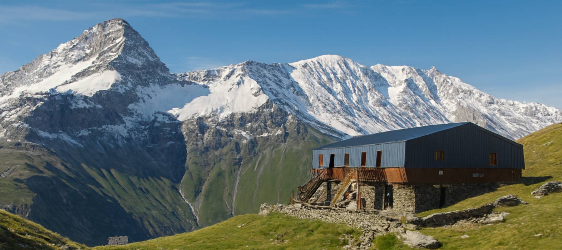
The Mont Pourri refuge (2,373 m), run by the French Alpine Club, can be reached from Landry by two routes: the “Nature” trail via Peisey-Nancroix (+820 m, 2 h 30-3 h) or the “Panoramic” route via Arc 2000 (2 h-2 h 30). Once there, enjoy a panorama over the glaciers and the homemade blueberry tart.
Key takeaways
- Mont Pourri refuge: at 2,373 m in the Vanoise National Park, with views over the glaciers.
- Run by the French Alpine Club, with an authentic welcome and mountain atmosphere.
- 2 recommended hiking routes from Landry: “Nature” via Peisey-Nancroix (moderate, +820 m, 2 h 30-3 h) and “Panoramic” via Arc 2000 (easy to moderate, +450 m / -200 m, 2 h-2 h 30).
- Access other than on foot: road, paid shuttle, car sharing / RézoPouce.
- Refuge food: soup, cheese and the famous blueberry tart.
Dreaming of a real breath of fresh air and a 360° panorama over the glaciers? Mont Pourri, the second-highest summit in the Vanoise, is waiting for you. Rest assured, this mountain only deserves its name (“rotten mountain”) for geologists (crumbly rock); for hikers, it is a promise of escape 36 km from L’Eden de la Vanoise, our campsite in Savoie. Today, we give you all the keys: the two main hiking routes from Landry, the access information and the foodie tip not to be missed once up there
Why is the Mont Pourri refuge a Savoie must-see?
Climbing to 2,373 metres means touching the clouds and approaching the Mont Pourri refuge. Built in 1974, it enjoys a unique view of the Alpine glaciers.
The atmosphere is unique. It is a mountain refuge run by the French Alpine Club (CAF). The professional welcome guarantees an authentic experience. You are in the heart of the Vanoise National Park, far from the noise. It is the perfect place to switch off.
Nearby, you will also discover the Regaud refuge, an old wooden building turned museum. Another curiosity not to be missed!
2 hiking routes from your campsite
Looking for the best route to the Mont Pourri refuge? From Landry, there is plenty of choice of trail. Here are 2 options for your hikes in the Vanoise.
1. The Nature route via Peisey-Nancroix (recommended)
From the Rosuel refuge, 12 km from your mountain campsite, you start the climb gently on the GR5. The trail zigzags up through a forest of larches and alders.
The trail then climbs more steeply. At the junction, leave the valley floor (which continues towards Lac de la Plagne) and turn left towards the refuge. You cross the stream on a footbridge before tackling the final climb through the pastures. The refuge only appears at the last moment!
Duration: 2 h 30-3 h; Ascent: +820 m; Difficulty: moderate.
2. The panoramic route via Arc 2000
From the resort of Arc 2000, 28 km from our holiday rentals in Landry, follow the dirt track towards the Chalet de l’Arc and the Saint-Jacques chapel.
- Just before the cheese-making chalets, take the waymarked “Circuit des lacs” trail on the left.
- The path crosses the pastures below the Saint-Jacques chairlift and leads you to Lac Saint-Jacques.
- It then climbs below the Dou de l’Homme chairlift and traverses the slope to a small plateau overlooking Lac de l’Homme. On the left, enjoy a superb view of the Varet and Grand Col glaciers.
- When you rejoin the track near Lac Marlou, follow it for 500 m, then climb left towards Lac des Moutons. The view then opens onto the Bellecôte range, the Aiguille Rouge and the Italian side of Mont Blanc.
- The trail continues south, descends into the valley along the Park boundary, then joins a track.
- Finally, enter the Vanoise National Park and follow the wide path to the refuge, hidden behind a mound.
Duration: 2 h-2 h 30; Ascent 450 m; Descent 200 m; Difficulty: easy to moderate.
Getting to the Mont Pourri refuge from Landry (other than on foot)
Here are the available options for getting to the Mont Pourri refuge, other than hiking:
| Type of access | Description | Notes |
|---|---|---|
| Road | Landry (D87) → Peisey-Nancroix | Standard road access to the end of the valley (Les Lanches / Rosuel). |
| Public transport – paid shuttle | Landry → Peisey shuttle | Runs only when the resorts are open. |
| Car sharing / organised hitchhiking | RézoPouce: stops between Peisey and Rosuel | Recommended alternative. |
Marmots and bearded vultures along the way: keep your eyes open!
On your route, you pass through the Vanoise Park. This is the territory of marmots and ibex. The sky belongs to the bearded vulture. Keep your eyes open around the Mont Pourri refuge so as not to miss any of its inhabitants!
Please note, the National Park has rules to preserve Savoie's biodiversity:
- No dogs.
- No picking.
- Respect the peace of the refuge.
The reward: blueberry tart or a night at the refuge!
Once up there, hunger strikes. The refuge food is excellent. Try the soup or a cheese platter. Save room for the famous blueberry tart! Eating opposite the glacier is the real motivation for your hike.
If you are tired, you can spend the night there. But booking your night at the Mont Pourri refuge in advance is compulsory!
We strongly recommend starting your mountain hike early and coming back down to Landry to enjoy the heated pool and facilities at l’Eden de la Vanoise. Unbeatable comfort after the effort of the trail.
Practical information
For a worry-free hike to the Mont Pourri refuge, prepare properly!
- Weather: always check the forecast before setting off. The weather changes quickly in the mountains.
- Navigation: the signal is weak. Remember to download the PDF route description or the GPX to your phone.
- Hiking season: from mid-June to mid-September. In winter, the trails can be dangerous due to snow on the pass.
- Equipment: good shoes are essential for the trail to the refuge.
The Mont Pourri refuge is a gem of Savoie. Discover it during your stay at L’Eden de la Vanoise! Book your mobile home now and plan your visit!
 Sébastien’s tip
Book your night at the refuge well in advance if you plan to sleep up there, places go quickly in high season. And download the route description or GPX track before you leave, there is almost no signal once you are in the Vanoise National Park.
See on the map